

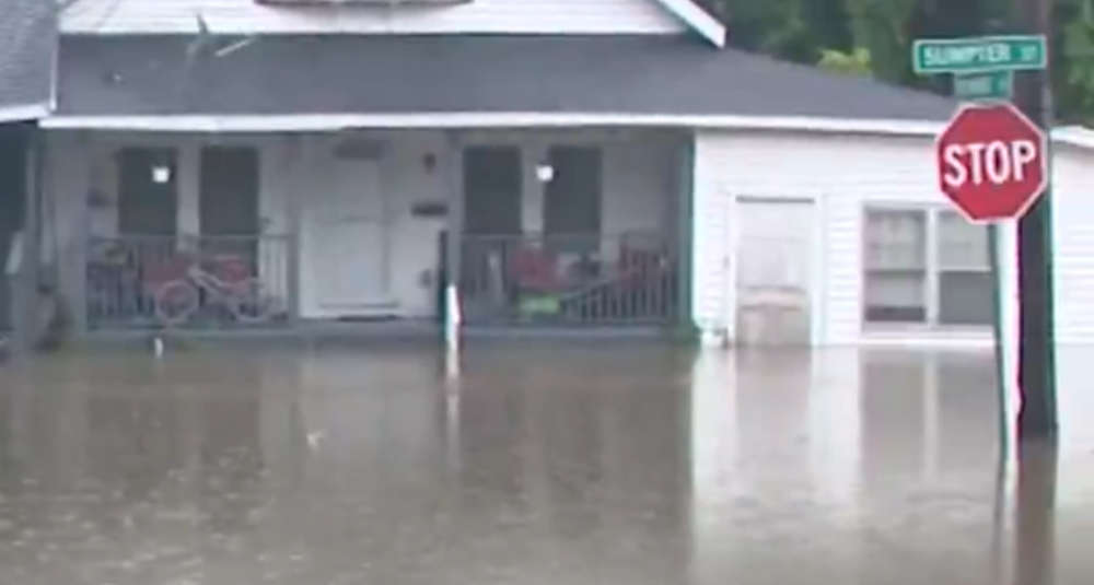
Several inches of rain fell during a historic storm on Wednesday.
The Capital Region was at the center of the Wednesday storm that dropped several inches of rain and caused flooding not seen since Hurricane Irene in 2011.
The National Weather Service released two maps on Thursday that show the estimated rain totals from the storm. Portions of Columbia, Greene and Rensselaer Counties saw the most - with some areas receiving close to a foot of rain. Even areas that weren't hit as hard still accumulated over an inch - which is a hefty amount on its own.
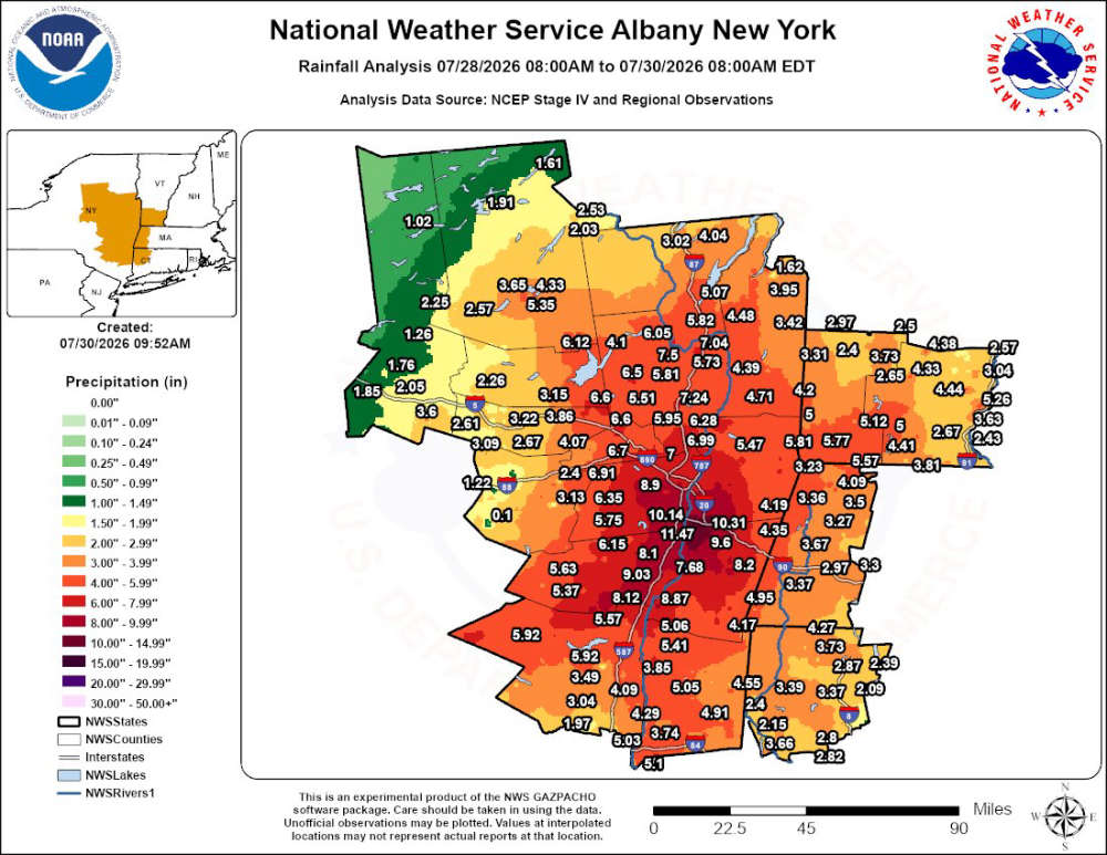
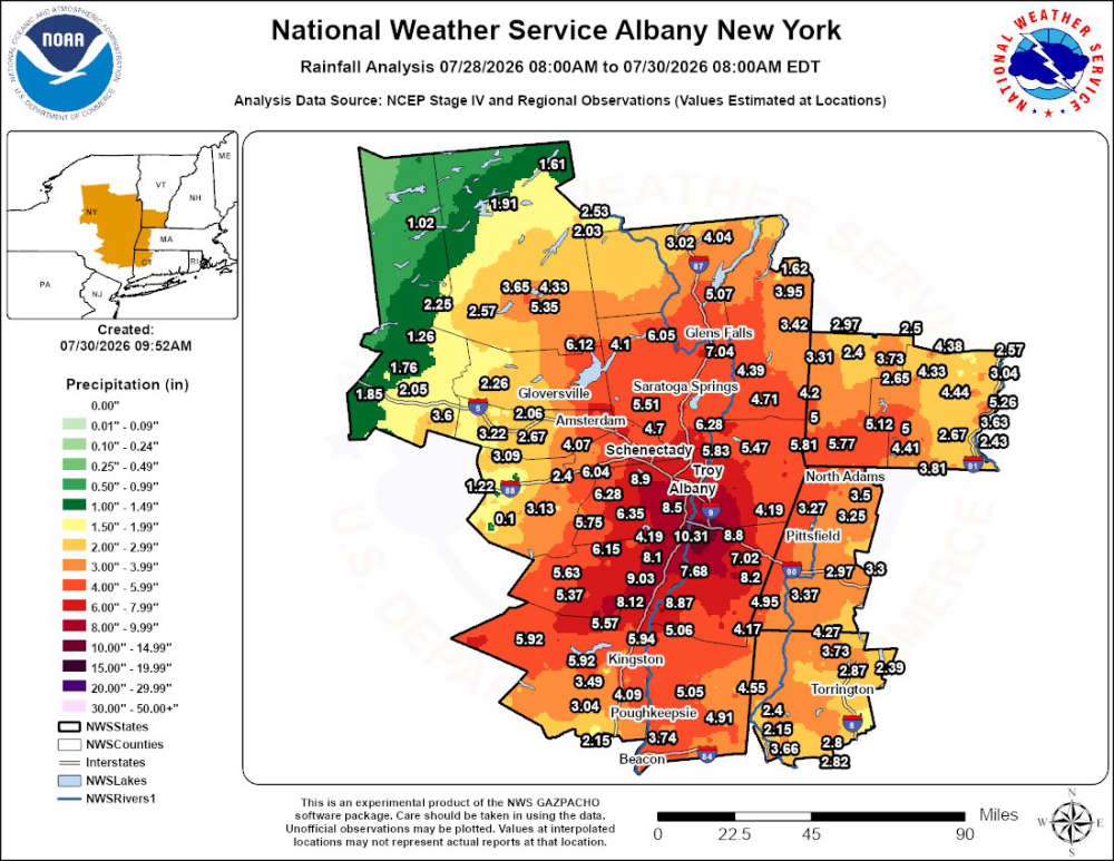
Historic rainfall totals made for some serious, and even catastrophic, flooding. The video coming into our newsroom over the last day has shown some almost unbelievable scenes. #MorningMinute pic.twitter.com/cDmFkpIdhG
— CBS 6 Albany - WRGB (@CBS6Albany) July 30, 2026
 Still Have a Landline? Verizon Is Making a Major Change
 National Cheeseburger Day Deals
 One of the Strongest People in the World is a Shen Student!
 Jimmer Fredette Comes Out of Retirement
 Johnny Rockets Returning to Crossgates